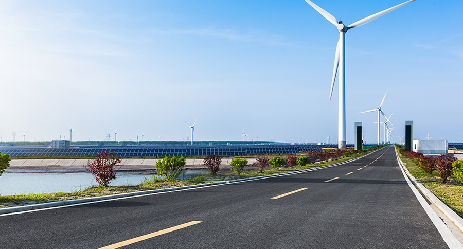
15 Aug The Ray: Solar Power Arrays along US Highways
The need for sustainability forces us to reimagine land use and resource allocation. The Ray, an Atlanta-based nonprofit, promotes a renewable energy purpose for land that is usually considered little more than a blank space along the nation’s highway system.
A highway right-of-way (ROW) is a buffer space—including shoulders, medians, rest stops, and turnoffs—that provides breathing room on high-speed thoroughfares. Most ROW land is shade free, which makes it an attractive location for generating solar energy.
The Ray works with state transportation departments to install solar arrays on ROW spaces. Georgia, Iowa, Oregon, and Massachusetts are among the states that have launched pilot projects. The company’s estimates indicate that many states have enough federal interstate freeway ROW land to support thousands of acres of solar arrays. The acreage around interchanges alone could generate 36 terawatt-hours of electricity, enough to fully charge 12 million EVs each year.
Locating suitable ROW land is no easy task, however, due to stringent requirements. The Ray uses a GIS tool with formulas and decision trees that help transportation engineers find ideal spots for solar arrays.
In Iowa, The Ray recently worked with planners to analyze site suitability on 238,000 acres of ROW land. Considerations included a rule that no array could be more than five miles from an electrical transmission line. The first step was to take a basemap of Iowa and overlay a data layer of transmission lines, with a five-mile buffer on either side of every line. Then the planners compared highway ROW land to see where the buffer and suitable land intersect.
The next step was to determine where the solar arrays could not be placed. Considerations included federal lands, protected lands, and urban areas, as well as any spots that were less than 500 feet from pipelines and less than 20 feet from railroad tracks. GIS is the perfect tool to combine layers of data and project constraints on a map where the situation can be visualized and analyzed. In Iowa, this level of location intelligence supported decision-making.
The result was 38,000 acres suitable for solar array installation, with the potential to generate five million megawatt-hours per year—that’s $400 million worth of electricity. The careful examination of layers of information is a location intelligence workflow that any organization can use to find suitable sites for assets. But considerations don’t stop there. It is important to know which spots, among the possibilities, are most cost-effective and have the greatest return on investment. Those considerations can be nearly limitless—the available nearby workforce, material sources and costs, the most favorable regulatory environment, jurisdictions that offer rebates and incentives, and more. Each of these inputs has some level of location advantage and can be analyzed with GIS.
The Iowa analysis went deeper still. The next step was to use solar radiation models, including maps of elevation and vegetation, to measure solar array potential. This information revealed which sites among Iowa’s ROW land should receive highest priority for solar array development.
Next, Iowa’s traffic engineers needed to understand what the arrays would look like from the ground. For that, they used GIS to generate a 3D digital twin of each possible site. Relevant data could then be entered into the model to ask questions such as these: How would an array affect the view from ascenic lookout? How might glare affect a nearby subdivision?
“Transportation engineers know about asphalt, concrete, bridges, and signage,” said Allie Kelly, The Ray’s executive director. “When we start talking about solar panels, this is infrastructure that isn’t native to them. The digital twin normalizes it.”
A location-intelligent digital twin made the effort relatable for the state’s engineers. On a broader scale, the use of a digital twin also allows various stakeholders to consider such issues as aesthetics, equity, and environmental justice. The Ray, for instance, can advocate for considering ROW lands that can also aid pollinators like birds and butterflies, thereby finding even more potential value in the projects.
The digital twin adds an element of human intelligence—the kinds of consideration any organization would need to make good decisions regarding possible sites—to the broader concept of location intelligence. As Kelly put it, “It lets us go from what we could do, to what we should do.”
Unleashing GIS Technology’s potential in every industries
