Transportation
Support data-driven decisions
GIS brings efficiencies and better information to bear across your organization. From planning to delivery, operations, and maintenance, bring the power of location intelligence to your organization. Use ArcGIS software to organize your information for better decisions and customer satisfaction.

Build a system of record
Organize and integrate information from across your organization to better support your business objectives.
Empower your workforce
Give each business unit the tailored information it needs on any device, anytime, anywhere.
Create seamless workflows
Bring spatial intelligence to your enterprise business systems. Break down silos and uncover deeper insight.
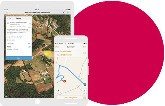
Take GIS to the field
Improve coordination and achieve operational efficiencies in field workforce activities. Reduce or even eliminate your reliance on paper.
EXPLORE A REAL-LIFE SCENARIO
Transportation officials need to decide where to invest in new infrastructure
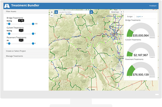
Local transportation planners are ready to plan for new infrastructure investments. Mapping bridge, culvert, and pavement condition ratings shows them areas of greatest need. A dashboard view summarizes potential costs in each road segment.
EXPLORE A REAL-LIFE SCENARIO
As construction begins, operations managers work to minimize traffic impacts
Now that planners have determined where to make improvements, operations professionals work to manage the work zones, respond to real time incidents to minimize congestion, and protect the safety of workers during construction.
EXPLORE A REAL-LIFE SCENARIO
A public-facing map keeps citizens informed every step of the way
During construction and maintenance, a map shows citizens where activities will take place and timelines so they stay informed about progress of these important improvements. They can also use the maps to determine where to avoid construction zones and traffic delays
EXPLORE A REAL-LIFE SCENARIO
Mapping the asset inventory helps staff in the field and office
With the project complete, crews and office staff map inspection information, asset condition, and work orders for efficient maintenance operations that extend the life of assets.
Case Study

Florida Department of Transportation
Esri’s technology aids projects from e-maintenance initiatives that use Survey123 and Collector for ArcGIS to facilitate data sharing between different counties.

Smart Transportation
ArcGIS platform helps you meet customer expectations while identifying cost savings and improving safety and security. Learn how ArcGIS is transforming transportation agencies.
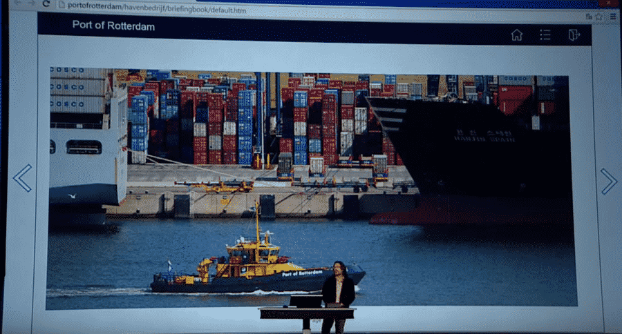
The Port of Rotterdam grows without expanding
At this busy port, a ship sails in every six minutes. ArcGIS software supports this massive goal and the mission to be the safest and most responsive, efficient, and sustainable port in the world.
Support data-driven decisions
GIS brings efficiencies and better information to bear across your organization. From planning to delivery, operations, and maintenance, bring the power of location intelligence to your organization. Use ArcGIS software to organize your information for better decisions and customer satisfaction.
Build a system of record
Organize and integrate information from across your organization to better support your business objectives.

Empower your workforce
Give each business unit the tailored information it needs on any device, anytime, anywhere.

Create seamless workflows
Bring spatial intelligence to your enterprise business systems. Break down silos and uncover deeper insight.

Take GIS to the field
Improve coordination and achieve operational efficiencies in field workforce activities. Reduce or even eliminate your reliance on paper.

EXPLORE A REAL-LIFE SCENARIO
Transportation officials need to decide where to invest in new infrastructure
Local transportation planners are ready to plan for new infrastructure investments. Mapping bridge, culvert, and pavement condition ratings shows them areas of greatest need. A dashboard view summarizes potential costs in each road segment.
EXPLORE A REAL-LIFE SCENARIO
As construction begins, operations managers work to minimize traffic impacts.
Now that planners have determined where to make improvements, operations professionals work to manage the work zones, respond to real time incidents to minimize congestion, and protect the safety of workers during construction.
EXPLORE A REAL-LIFE SCENARIO
A public-facing map keeps citizens informed every step of the way
During construction and maintenance, a map shows citizens where activities will take place and timelines so they stay informed about progress of these important improvements. They can also use the maps to determine where to avoid construction zones and traffic delays
EXPLORE A REAL-LIFE SCENARIO
Mapping the asset inventory helps staff in the field and office
With the project complete, crews and office staff map inspection information, asset condition, and work orders for efficient maintenance operations that extend the life of assets.
Case Study

Florida Department of Transportation
Esri’s technology aids projects from e-maintenance initiatives that use Survey123 and Collector for ArcGIS to facilitate data sharing between different counties.

Smart Transportation
ArcGIS platform helps you meet customer expectations while identifying cost savings and improving safety and security. Learn how ArcGIS is transforming transportation agencies.

The Port of Rotterdam grows without expanding
At this busy port, a ship sails in every six minutes. ArcGIS software supports this massive goal and the mission to be the safest and most responsive, efficient, and sustainable port in the world.
