COVID-19 GIS Hub
Get maps, datasets, applications, and more for coronavirus
disease 2019 (COVID-19).
Check back often—these resources will be updated with new
information as it becomes available.
As the situation surrounding the coronavirus disease 2019 (COVID-19) continues to evolve,
Esri is supporting our users and the community at large with software, services, and materials
that are helping people understand, manage, and communicate the impact of the outbreak.
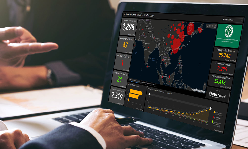
Coronavirus Situation Dashboard
ด้วยเทคโนโลยี GIS จะช่วยให้คุณคิดวางแผน และรับมือกับสถานการณ์อย่างมีประสิทธิภาพมากยิ่งขึ้น
Five steps to understand the potential impact COVID-19 can have
on your organization and community
Step 1
Map the cases
Map confirmed and active cases, fatalities, and recoveries cases to identify where COVID-19 infections exist and have occurred.
Step 2
Map the spread
Time-enabled maps can reveal how infections spread over time and where you may want to target interventions.
Step 3
Map vulnerable populations
COVID-19 disproportionally impacts certain demographics such as the elderly and those with underlying health conditions. Mapping social vulnerability, age, and other factors helps you monitor the most at-risk groups and regions.
Step 4
Map your capacity
Map facilities, employees or citizens, medical resources, equipment, goods, and services to understand and respond to current and potential impacts of COVID-19.
Step 5
Communicate with maps
Use interactive web maps, dashboard apps, and story maps to help rapidly communicate your situation.
Access the Esri COVID-19 GIS Hub
On the COVID-19 GIS Hub, you will find valuable and ready-to-use demographic and other data from authoritative sources, our user community, and business partners.
You will also find practical apps that immediately aid better understanding and decision-making. This includes a collection of datasets, applications, and other useful content for your planning and response.
These materials will be updated with new content as it becomes available.

Build Your Own Hub Site with a Free ArcGIS Hub Template
To jump-start your own response, we are providing you an ArcGIS Hub Coronavirus Response template at no cost. The template includes examples, materials, and configurations to rapidly deploy your ArcGIS Hub environment. ArcGIS Hub is a framework to build your own website to visualize and analyze the crisis in the context of your organization’s or community’s population and assets.
If you do not have ArcGIS Online, Esri will donate ArcGIS Online with ArcGIS Hub Basic for six months. To activate your COVID-19 ArcGIS Online and Hub Donation, go to https://www.esri.com/disaster and click Request Assistance.
Once you have your donation or if you already have ArcGIS Online, go to the app launcher, navigate to ArcGIS Hub, click new site, browse the gallery, and activate the Coronavirus Response template.
Request Additional Assistance from Esri’s Disaster Response Program
If your organization’s GIS capacity is exceeded, and you need emergency support, there are several ways we may be able to help. We provide free GIS technology and on-call technical experts. We can help you with data, software, configuration, and technical support for your applications. Our team is ready to help.

Esri has set up a focused support program that can help you and your organization manage this crisis.
We are making resources available at no cost that can help you prepare, manage,
and deliver an effective response to COVID‑19.

COVID-19: Taking Comfort from the Past
Calling the COVID-19 pendemic the new normal may miss the fact that througout history, normal is constantly changing.
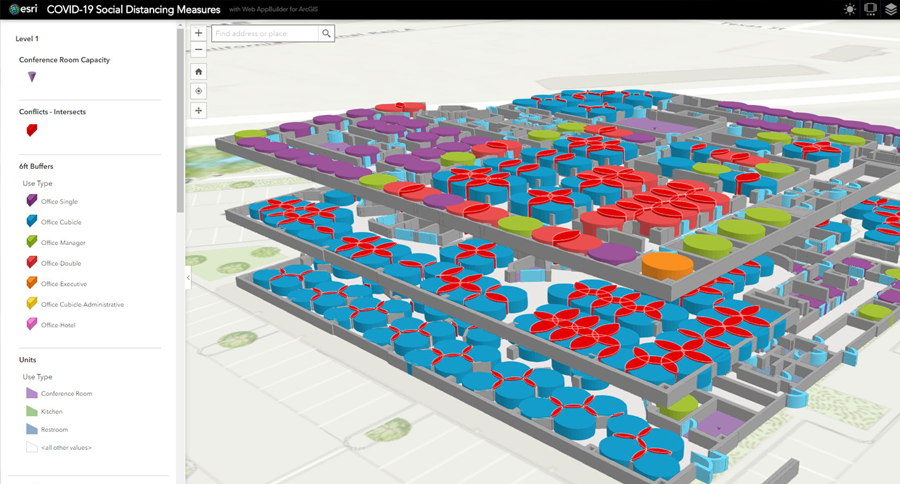
How to Reopen the Workplace during COVID-19
COVID-19 has undermined workplace safety in profound ways. A guide for business leaders on reopening the office and ensuring workplace safely.

GISCorps Builds an Authoritative Map of COVID-19 Testing Sites
GISCorps rallied its expert mapping members to address a critical COVID-19 data gap: the sites of testing facilities across the nation
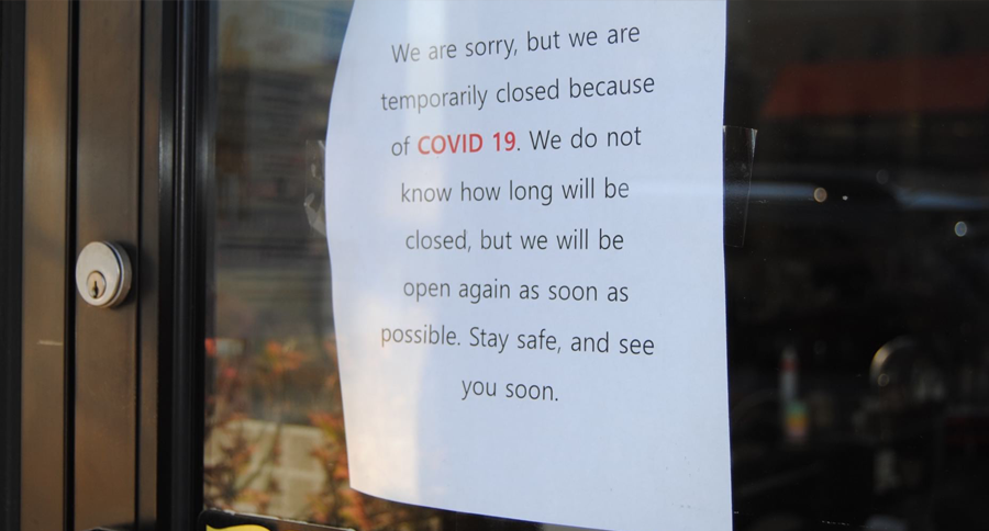
State and Local Government Open Data Sites Share COVID-19 News, Resources
ArcGIS Hub allows governments to compile data, maps, apps, and dashboards into one-stop destination websites to communicate local details about the global crisis.
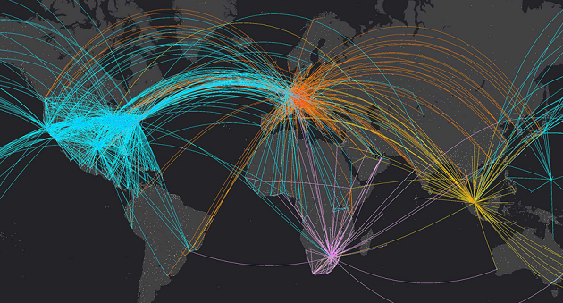
Reliable Data Is Helping Businesses Respond to COVID-19
Companies are showing that business continuity during the COVID-19 pandemic is a function of reliable data and strong location intelligence.

Models and Maps Explore COVID-19 Surges and Capacity to Help Officials Prepare
GIS users combine models and maps to explore hospital capacity forecasts and test the impact of different social distancing scenarios.
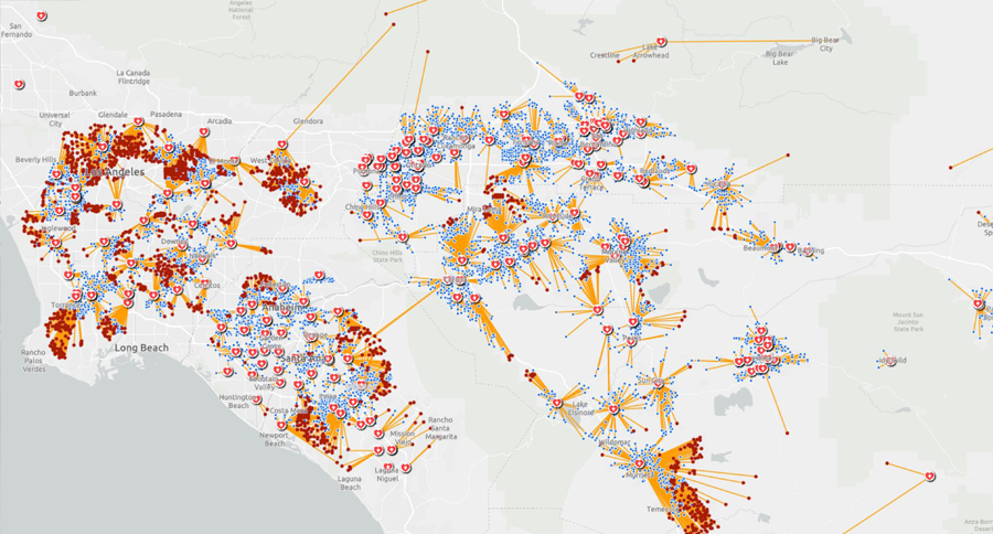
Smart Maps Guide COVID-19 Investigations and Actions, and Monitor Effectiveness
As the World Health Organization declared a pandemic, it also said it can be controlled. Location intelligence has a key role to play in COVID-19 response.
As the situation surrounding the coronavirus disease 2019 (COVID-19) continues to evolve,
Esri is supporting our users and the community at large with software, services, and materials
that are helping people understand, manage, and communicate the impact of the outbreak.
Coronavirus Situation Dashboard
Understand, prepare for, and respond to COVID-19 in your community or organization.
Five steps to understand the potential impact COVID-19 can have
on your organization and community
Step 1
Map the cases
Map confirmed and active cases, fatalities, and recoveries cases to identify where COVID-19 infections exist and have occurred.
Step 2
Map the spread
Time-enabled maps can reveal how infections spread over time and where you may want to target interventions.
Step 3
Map vulnerable populations
COVID-19 disproportionally impacts certain demographics such as the elderly and those with underlying health conditions. Mapping social vulnerability, age, and other factors helps you monitor the most at-risk groups and regions.
Step 4
Map your capacity
Map facilities, employees or citizens, medical resources, equipment, goods, and services to understand and respond to current and potential impacts of COVID-19.
Step 5
Communicate with maps
Use interactive web maps, dashboard apps, and story maps to help rapidly communicate your situation.

Access the Esri COVID-19
GIS Hub
On the COVID-19 GIS Hub, you will find valuable and ready-to-use demographic and other data from authoritative sources, our user community, and business partners.
You will also find practical apps that immediately aid better understanding and decision-making. This includes a collection of datasets, applications, and other useful content for your planning and response.
These materials will be updated with new content as it becomes available.

Build Your Own Hub Site with
a Free ArcGIS Hub Template
To jump-start your own response, we are providing you an ArcGIS Hub Coronavirus Response template at no cost. The template includes examples, materials, and configurations to rapidly deploy your ArcGIS Hub environment. ArcGIS Hub is a framework to build your own website to visualize and analyze the crisis in the context of your organization’s or community’s population and assets.
If you do not have ArcGIS Online, Esri will donate ArcGIS Online with ArcGIS Hub Basic for six months. To activate your COVID-19 ArcGIS Online and Hub Donation, go to https://www.esri.com/disaster and click Request Assistance.
Once you have your donation or if you already have ArcGIS Online, go to the app launcher, navigate to ArcGIS Hub, click new site, browse the gallery, and activate the Coronavirus Response template.

Request Additional Assistance
from Esri’s Disaster Response Program
If your organization’s GIS capacity is exceeded, and you need emergency support, there are several ways we may be able to help. We provide free GIS technology and on-call technical experts. We can help you with data, software, configuration, and technical support for your applications. Our team is ready to help.
Esri has set up a focused support program that can help you and your organization manage this crisis. We are making resources available at no cost that can help you prepare, manage, and deliver an effective response to COVID‑19.
Stay current on COVID-19 with up-to-date content from trusted resources.

COVID-19: Taking Comfort from the Past
Calling the COVID-19 pendemic the new normal may miss the fact that througout history, normal is constantly changing.

How to Reopen the Workplace during COVID-19
COVID-19 has undermined workplace safety in profound ways. A guide for business leaders on reopening the office and ensuring workplace safely.

GISCorps Builds an Authoritative Map of COVID-19 Testing Sites
GISCorps rallied its expert mapping members to address a critical COVID-19 data gap: the sites of testing facilities across the nation

State and Local Government Open Data Sites Share COVID-19 News, Resources
ArcGIS Hub allows governments to compile data, maps, apps, and dashboards into one-stop destination websites to communicate local details about the global crisis.

Reliable Data Is Helping Businesses Respond to COVID-19
Companies are showing that business continuity during the COVID-19 pandemic is a function of reliable data and strong location intelligence.

Models and Maps Explore COVID-19 Surges and Capacity to Help Officials Prepare
GIS users combine models and maps to explore hospital capacity forecasts and test the impact of different social distancing scenarios.

Smart Maps Guide COVID-19 Investigations and Actions, and Monitor Effectiveness
As the World Health Organization declared a pandemic, it also said it can be controlled. Location intelligence has a key role to play in COVID-19 response.