Mapping solution for military support
Currently, the GIS technology plays a bigger part in military solutions. The technology can make digital maps. The ArcGIS software can also be used as analytical tool on a personal computer or harnessed to build applications that run on web browsers or on cloud. The technology is also capable of building programmes that work on mobile platforms be they smartphones or tablets.

Mapping Organizations
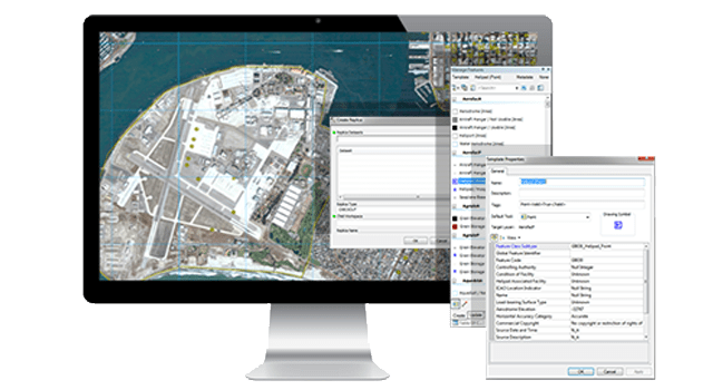
The ArcGIS’s mapping programme can render a variety of maps with reference layers. These include flight navigation, navigation charts, military surveys and specialised maps that users can design by themselves. Once users select the preferred mapping programme, they need not worry about the process or tools as the system will prepare everything automatically.
Intelligence
The ArcGIS is perfect for intelligence as it can manage, analyse and collect information from different sources — all on a single platform. The data can be used for a situational analysis, published or incorporated into an intelligence life cycle. The ArcGIS for Intelligence works in two major areas:
National Intelligence
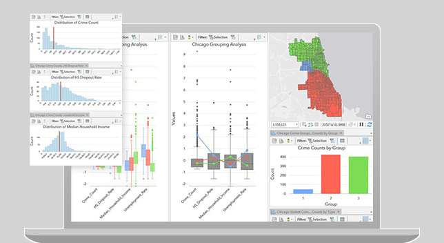
With the software, intelligence data can be interpreted and presented as interactive maps to help with planning and decision making. The feature is suitable for many operations including crime-prevention or intelligence gathering.
Military Intelligence
This feature is specially designed to support military operations as it can show the opposite side’s military force deployment or attack patterns.


Operations
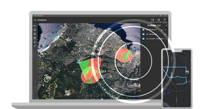
The programme is a valuable support for military land operations. It can simulate different situations which are helpful for operations planning. It can synchronise and process intelligence data before presenting them in a graphic map form. The feature is a useful decision-making tool. It can also do the planning, operation administration as well as prepare analyses and work with ArcGIS’s built-in, pre-designed processes. The tools, processes or map variations can be readily downloaded and utilized. These include tools to make standard 2525c maps or to analyse weapon trajectories.
Sustainment
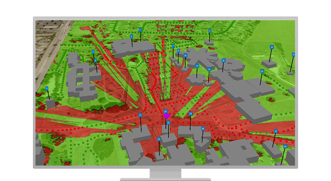
The GIS technology is suitable for the management of space, buildings and other facilities within military bases. It can also be used to map out offensive operations to ensure the security and safety of these crucial areas.

Mapping solution for military support
Currently, the GIS technology plays a bigger part in military solutions. The technology can make digital maps. The ArcGIS software can also be used as analytical tool on a personal computer or harnessed to build applications that run on web browsers or on cloud. The technology is also capable of building programmes that work on mobile platforms be they smartphones or tablets.

Mapping Organizations
The ArcGIS’s mapping programme can render a variety of maps with reference layers. These include flight navigation, navigation charts, military surveys and specialised maps that users can design by themselves. Once users select the preferred mapping programme, they need not worry about the process or tools as the system will prepare everything automatically.

Intelligence
The ArcGIS is perfect for intelligence as it can manage, analyse and collect information from different sources — all on a single platform. The data can be used for a situational analysis, published or incorporated into an intelligence life cycle. The ArcGIS for Intelligence works in two major areas:
National Intelligence
With the software, intelligence data can be interpreted and presented as interactive maps to help with planning and decision making. The feature is suitable for many operations including crime-prevention or intelligence gathering.
Military Intelligence
This feature is specially designed to support military operations as it can show the opposite side’s military force deployment or attack patterns.

Operations
The programme is a valuable support for military land operations. It can simulate different situations which are helpful for operations planning. It can synchronise and process intelligence data before presenting them in a graphic map form. The feature is a useful decision-making tool. It can also do the planning, operation administration as well as prepare analyses and work with ArcGIS’s built-in, pre-designed processes. The tools, processes or map variations can be readily downloaded and utilized. These include tools to make standard 2525c maps or to analyse weapon trajectories.

Sustainment
The GIS technology is suitable for the management of space, buildings and other facilities within military bases. It can also be used to map out offensive operations to ensure the security and safety of these crucial areas.
