GeoAI
AI-driven geospatial
workflows
Discover how organizations are building a more resilient future with accelerated spatial problem-solving
GeoAI
AI-driven geospatial
workflows
Discover how organizations are building a more resilient future with accelerated spatial problem-solving
What is GeoAI?
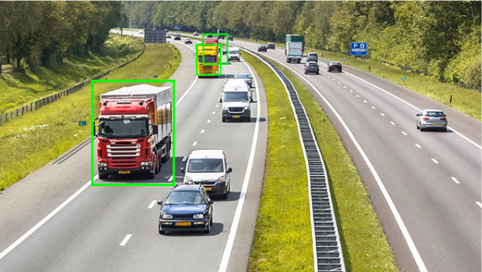
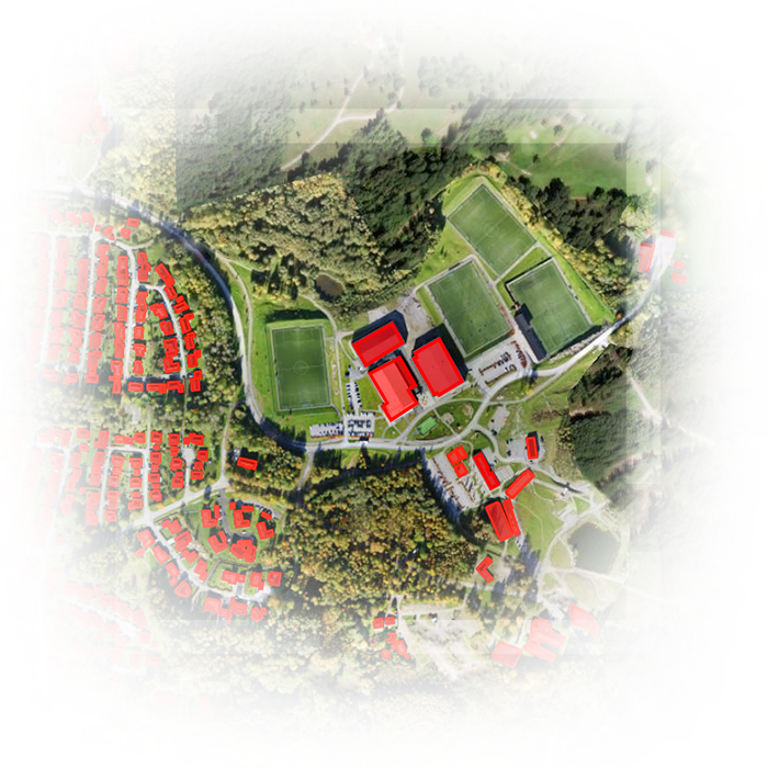
Geospatial artificial intelligence (GeoAI) is the application of artificial intelligence (AI) fused with geospatial data, science, and technology to accelerate real-world understanding of business opportunities, environmental impacts, and operational risks. Organizations are modernizing operations to run at scale through automated data generation and approachable spatial tools and algorithms.
01. Extract rich geospatial data with deep learning
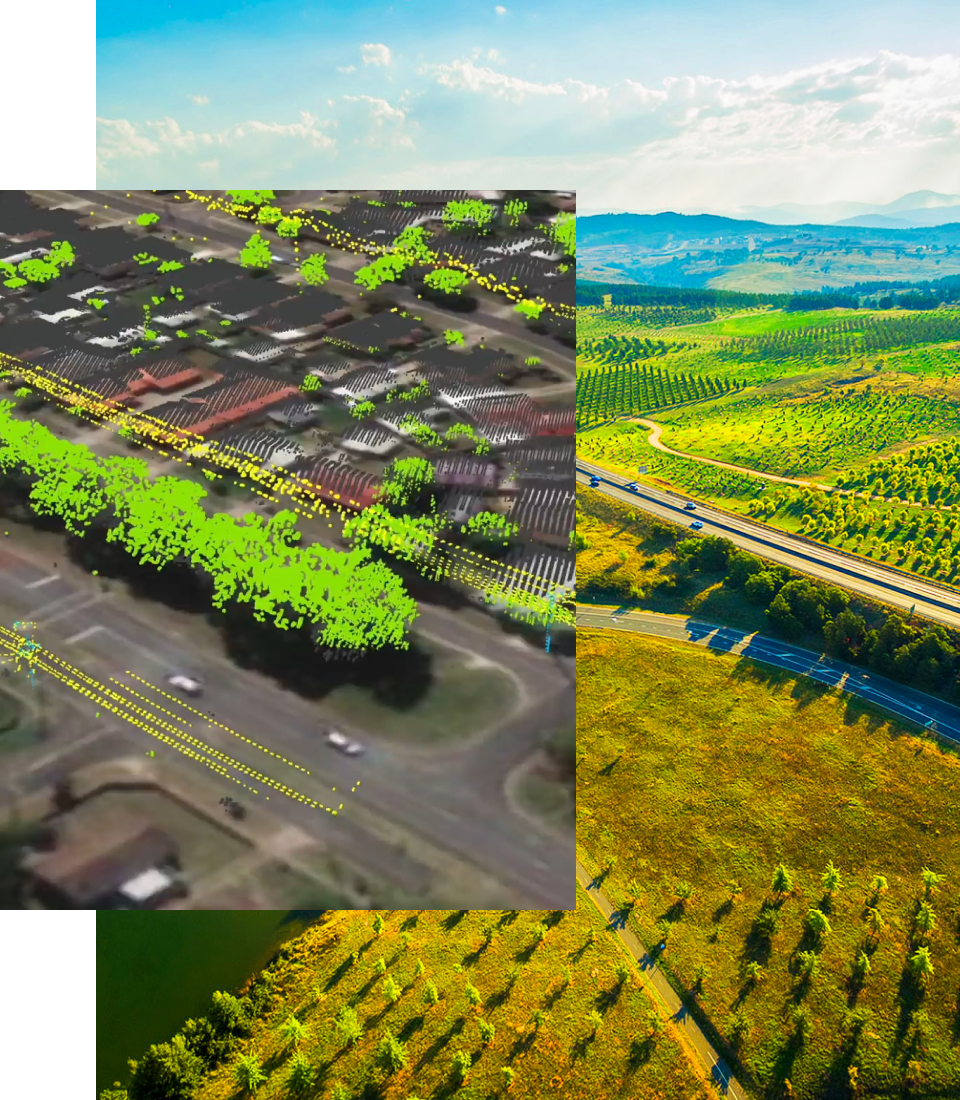
Save time by automating the extraction, classification, and detection of information from data such as imagery, video, point clouds, and text.
02. Perform predictive analysis using machine learning
Build more accurate models. Detect clusters, calculate change, find patterns, and forecast outcomes with spatial algorithms backed by experts.
Why is GeoAI important?
GeoAI is transforming the speed at which we extract meaning from complex datasets, thereby aiding us in addressing the earth’s most pressing challenges. It reveals and helps us perceive intricate patterns and relationships in a variety of data that continues to grow exponentially. Organizations leveraging GeoAI are revolutionizing how they turn data into information, with models that adapt even as data evolves.
01. Improve data quality, consistency, and accuracy
Streamline manual data generation workflows by using the power of automation to increase efficiency and reduce costs.
02. Accelerate the time to situational awareness
Monitor and analyze events, assets, and entities from sensors and sources such as video to enable quicker response times and proactive decisions.
03. Bring location intelligence to decision-making
Make data-driven decisions with real-world awareness.
Improve business outcomes with insight from spatial patterns and accurate predictions.
How is GeoAI used?
GeoAI is used in various industries and applications to tackle challenges and proactively seize
opportunities. Explore how GeoAI is used to optimize crop yields, heighten community safety,
streamline asset inspection, shorten emergency response times, and more.
State and local government
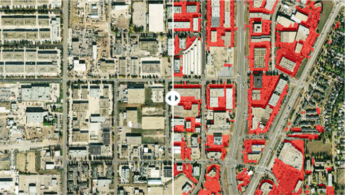
GeoAI is accelerating the speed at which government officials better serve communities using data. By leveraging GeoAI, governments can model the impacts of urban development, understand the availability of resources to the population, forecast road and infrastructure deterioration, and identify land-use change (such as new buildings) to proactively take action.
Natural resources
GeoAI is revolutionizing the precision agriculture market by aiding the automated detection of invasive species. It helps the oil and gas industry monitor assets through automated extraction of flares, new well pads, or field access roads. Foresters and landowners use GeoAI to give them knowledge about the volumes and species of trees without a time-consuming on-site inspection.
National mapping and statistics
GeoAI is enhancing the responsiveness, productivity, and speed of product delivery for national mapping agencies. Through automation, these organizations are scaling their internal capacities and production workflows. A national mapping department can quickly update a nation’s geographic information system (GIS) in hours, not months or days.
Defense and intelligence
GeoAI is speeding up how organizations extract information, identify patterns, and determine changes in big data. An intelligence organization can support its activity-based intelligence efforts by automating how they analyze information related to events, entities, surveillance video, and remotely sensed data.
Public safety
GeoAI is improving public safety as it relates to traffic accidents, emergency response, and disaster management. Organizations are making communities safer by predicting where accidents are likely to occur and optimizing emergency response times. Damaged infrastructure and navigable roads can be quickly identified to help allocate first responders.
Insurance
GeoAI is helping insurance organizations understand the impact of an event in hours instead of days to improve claim processing and efficiently help members. Insurance companies can use imagery and GeoAI to detect and classify damage that impacts its members. With this understanding, they can get members back on their feet more quickly.
AEC
GeoAI is transforming the architecture, engineering, and construction (AEC) industry with its ability to extract information from imagery, which feeds a digital twin. This data allows decision-makers to improve project management, identify potential risks, and optimize building performance. As a result, architecture firms can design energy-efficient buildings.
Business
GeoAI is accelerating smart business decisions, delivering insight and predictions that drive better market planning, site selection, supply chain efficiency, and customer intelligence. With these insights, a business can respond to customer behavior and determine whether a new market area is viable based on pattern and predictive analysis of market characteristics.
Getting started with Esri
Shorten the time to insights
Combine the world’s most powerful GIS and location intelligence software with the scalability
and power of AI. Esri’s long-standing expertise gives you a trusted solution for extracting
meaning from big data. Eliminate the need for large amounts of training data, massive compute
resources, and extensive AI knowledge. Modernize how you approach spatial problems at scale
with Esri.
You don’t have to start from scratch
Getting started with GeoAI can sometimes feel like a daunting task. Use pretrained deep learning models and spatial machine learning tools backed by spatial experts. Our trained deep learning models provide the means for anyone to start extracting, classifying, detecting, and problem-solving with the data you have—no training data required. And our machine learning tools allow you to get started with UI-based tools with data-driven defaults that help guide you.
Dive deeper
Discover more about spatial analysis, spatial data science, and working with remotely sensed data
in ArcGIS.
Spatial analysis and data science
Use location as the connective thread to uncover hidden patterns, improve predictive modeling, and create a competitive edge.
Imagery and remote sensing
Unpack more information from every pixel and transform static images into dynamic digital representations of our world.
What is GeoAI?
Geospatial artificial intelligence (GeoAI) is the application of artificial intelligence (AI) fused with geospatial data, science, and technology to accelerate real-world understanding of business opportunities, environmental impacts, and operational risks. Organizations are modernizing operations to run at scale through automated data generation and approachable spatial tools and algorithms.
01. Extract rich geospatial data with deep learning
Save time by automating the extraction, classification, and detection of information from data such as imagery, video, point clouds, and text.
02. Perform predictive analysis using machine
learning
Build more accurate models. Detect clusters, calculate change, find patterns, and forecast outcomes with spatial algorithms backed by experts.

Why is GeoAI important?
GeoAI is transforming the speed at which we extract meaning from complex datasets, thereby aiding us in addressing the earth’s most pressing challenges. It reveals and helps us perceive intricate patterns and relationships in a variety of data that continues to grow exponentially. Organizations leveraging GeoAI are revolutionizing how they turn data into information, with models that adapt even as data evolves.
01. Improve data quality, consistency, and accuracy
Streamline manual data generation workflows by using the power of automation to increase efficiency and reduce costs.
02. Accelerate the time to situational awareness
Monitor and analyze events, assets, and entities from sensors and sources such as video to enable quicker response times and proactive decisions.
03. Bring location intelligence to decision-making
Make data-driven decisions with real-world awareness.
Improve business outcomes with insight from spatial patterns and accurate predictions.
How is GeoAI used?
GeoAI is used in various industries and applications to tackle challenges and proactively seize
opportunities. Explore how GeoAI is used to optimize crop yields, heighten community safety,
streamline asset inspection, shorten emergency response times, and more.
State and local government
GeoAI is accelerating the speed at which government officials better serve communities using data. By leveraging GeoAI, governments can model the impacts of urban development, understand the availability of resources to the population, forecast road and infrastructure deterioration, and identify land-use change (such as new buildings) to proactively take action.
Natural resources
GeoAI is revolutionizing the precision agriculture market by aiding the automated detection of invasive species. It helps the oil and gas industry monitor assets through automated extraction of flares, new well pads, or field access roads. Foresters and landowners use GeoAI to give them knowledge about the volumes and species of trees without a time-consuming on-site inspection.
National mapping and statistics
GeoAI is enhancing the responsiveness, productivity, and speed of product delivery for national mapping agencies. Through automation, these organizations are scaling their internal capacities and production workflows. A national mapping department can quickly update a nation’s geographic information system (GIS) in hours, not months or days.
Defense and intelligence
GeoAI is speeding up how organizations extract information, identify patterns, and determine changes in big data. An intelligence organization can support its activity-based intelligence efforts by automating how they analyze information related to events, entities, surveillance video, and remotely sensed data.
Public safety
GeoAI is improving public safety as it relates to traffic accidents, emergency response, and disaster management. Organizations are making communities safer by predicting where accidents are likely to occur and optimizing emergency response times. Damaged infrastructure and navigable roads can be quickly identified to help allocate first responders.
Insurance
GeoAI is helping insurance organizations understand the impact of an event in hours instead of days to improve claim processing and efficiently help members. Insurance companies can use imagery and GeoAI to detect and classify damage that impacts its members. With this understanding, they can get members back on their feet more quickly.
AEC
GeoAI is transforming the architecture, engineering, and construction (AEC) industry with its ability to extract information from imagery, which feeds a digital twin. This data allows decision-makers to improve project management, identify potential risks, and optimize building performance. As a result, architecture firms can design energy-efficient buildings.
Business
GeoAI is accelerating smart business decisions, delivering insight and predictions that drive better market planning, site selection, supply chain efficiency, and customer intelligence. With these insights, a business can respond to customer behavior and determine whether a new market area is viable based on pattern and predictive analysis of market characteristics.
Getting started with Esri
Shorten the time to insights
Combine the world’s most powerful GIS and location intelligence software with the scalability
and power of AI. Esri’s long-standing expertise gives you a trusted solution for extracting
meaning from big data. Eliminate the need for large amounts of training data, massive compute
resources, and extensive AI knowledge. Modernize how you approach spatial problems at scale
with Esri.

You don’t have to start from scratch
Getting started with GeoAI can sometimes feel like a daunting task. Use pretrained deep learning models and spatial machine learning tools backed by spatial experts. Our trained deep learning models provide the means for anyone to start extracting, classifying, detecting, and problem-solving with the data you have—no training data required. And our machine learning tools allow you to get started with UI-based tools with data-driven defaults that help guide you.
Dive deeper
Discover more about spatial analysis, spatial data science, and working with remotely sensed data
in ArcGIS.
Spatial analysis and data science
Use location as the connective thread to uncover hidden patterns, improve predictive modeling, and create a competitive edge.
Imagery and remote sensing
Unpack more information from every pixel and transform static images into dynamic digital representations of our world.
Related Articles

The rise of artificial intelligence meets the golden age of geography
Millions of maps are made each day, specifically data-rich maps that guide predictions and decisions for the world’s largest organisations.

Generative AI Enhances GIS across the Enterprise
Ever since generative AI applications debuted in late 2022, companies in nearly every industry have been racing to integrate GenAI into business processes, hoping to boost productivity and optimize efficiency.
Related Articles

The rise of artificial intelligence meets the golden age of geography
Millions of maps are made each day, specifically data-rich maps that guide predictions and decisions for the world’s largest organisations.

Generative AI Enhances GIS across the Enterprise
Ever since generative AI applications debuted in late 2022, companies in nearly every industry have been racing to integrate GenAI into business processes, hoping to boost productivity and optimize efficiency.

