18 Jun ArcGIS solution for Telecommunications : Enabling telecommunications organizations to more efficiently serve customers
Across the telecommunications industry, GIS and location intelligence have become essential technology to support network engineering, network operations, sales and marketing, and customer service. Telecommunications organizations can leverage ArcGIS Solutions to quickly configure ArcGIS to manage telecommunication system data, optimize backhaul routes, and match customers with services.
Manage Network
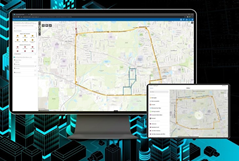
Communications Data Management for ArcGIS Online
Communications Data Management for ArcGIS Online can be used to manage coax, copper, fiber, and wireless systems to map assets, edit data, view system maps in the field and office, view asset reports, and collaborate with map notes. After deploying, organizations with no data can immediately begin mapping their communications assets using GPS or digitizing data with web or desktop applications. Organizations with existing spatial communication asset data can load it and begin using the apps immediately.
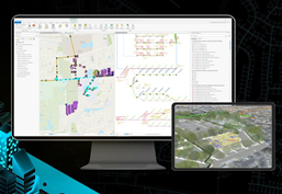
Communications Data Management for ArcGIS Enterprise
Communications Data Management for ArcGIS Enterprise can be used to map and manage coax, copper, fiber, and wireless communication asset information with the ArcGIS Utility Network. Communications Data Management for ArcGIS Enterprise delivers a data model that makes a utility network behave like a communication network, editing app configured for ArcGIS Pro and preconfigured maps for data sharing. It also provides a sample utility network dataset so users can experience a utility network in a single user environment.
Optimize network planning
Network Path Planner
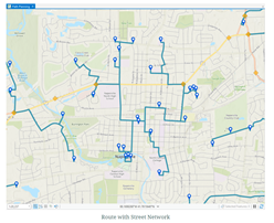
Network Path Planner can be used to plan fronthaul routes to wireless equipment such as 5G sites, backhaul routes from wireless towers, and plan routes to residential neighborhoods or business locations. The Network Path Planner solution delivers a set of capabilities that help you create an optimized fiber route and estimate the cost of the route.
3D Basemaps
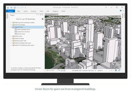
3D Basemaps can be used to author and maintain a 3D basemap for your organization. 3D Basemaps is typically implemented by planning departments, emergency management agencies, GIS departments, and utilities that want to use 3D basemaps to visualize the built environment. The 3D Basemaps solution delivers a set of capabilities that help you use existing data (for example, lidar, building footprints, utilities), develop a standard set of 3D layers, and visualize your community in an immersive way.
Support sales and operations
Coverage Processing
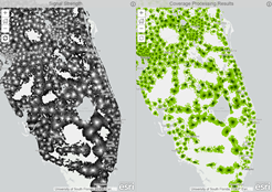
Coverage Processing can be used to process raster RF signal strength data output from RF planning tools into cleaned and simplified polygon data that is easy to visualize and understand. Output from the solution can be shared in applications for sales and customer staff to determine signal strengths for locations within a service area. Output can also be used in applications to help customers visualize coverage in their area.
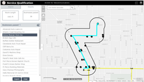
Service Qualification
Service Qualification can be used to determine service availability for customer addresses and use business locations to optimize network routes. Planners and sales staff can use the solution to rapidly respond to customer requests to increase competitiveness and can evaluate alternate routing options to increase profitability.
